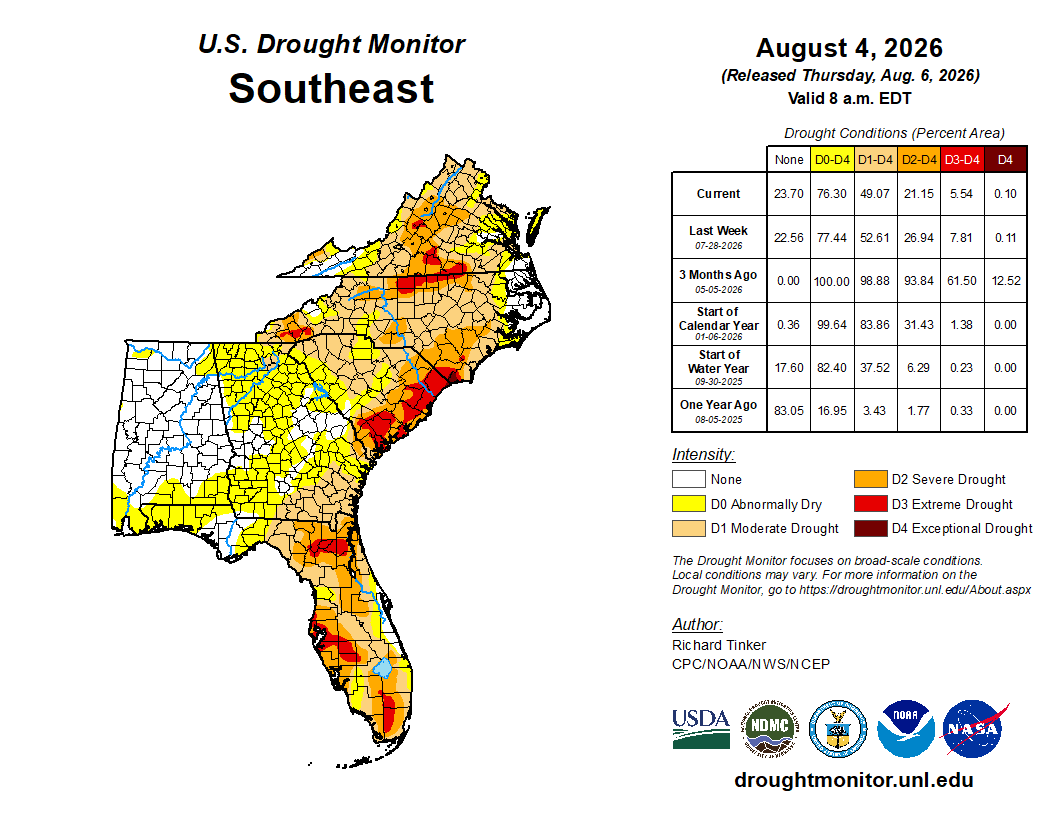
Days of heavy rainfall have helped chip away at Florida's drought, but the latest U.S. Drought Monitor shows the state is far from fully recovering.
Why it matters: The new map, valid Aug. 4, shows drought conditions have improved compared with three months ago, when much of Florida was experiencing extreme drought. Even so, more than 40% of the state remains in severe drought (D2) or worse, with pockets of extreme drought (D3) still lingering across parts of Central (Tampa area remains in extreme drought) and South Florida.
What it means for Tampa Bay
Recent rounds of tropical downpours have provided much-needed rainfall across the region, but experts say a few wet weeks don't erase months of rainfall deficits.
That means Tampa Bay residents could experience two weather extremes at the same time:
- Localized flooding during heavy afternoon thunderstorms.
- Continued drought impacts on groundwater, lakes and vegetation between rain events.
The pattern highlights how Florida's sandy soils quickly shed heavy rainfall, limiting how much water reaches deeper aquifers.
Looking ahead
Scattered afternoon storms are expected to continue over the coming days, bringing additional opportunities for beneficial rainfall. Longer term, forecasters are also watching for the possibility of a wetter El Niño pattern developing this winter, which could help reduce remaining drought conditions across Florida.
Disaster resilience takeaway
Recent flooding doesn't mean the drought is over. Residents should continue conserving water where possible, stay alert for rapidly changing weather and remember that heavy rainfall can create dangerous street flooding even while broader drought conditions persist.
Bottom line: Florida's weather is showing two sides of the same story. Heavy summer storms are improving drought conditions, but much of the state, including areas surrounding Tampa Bay, still has a long way to go before rainfall deficits are fully erased.

