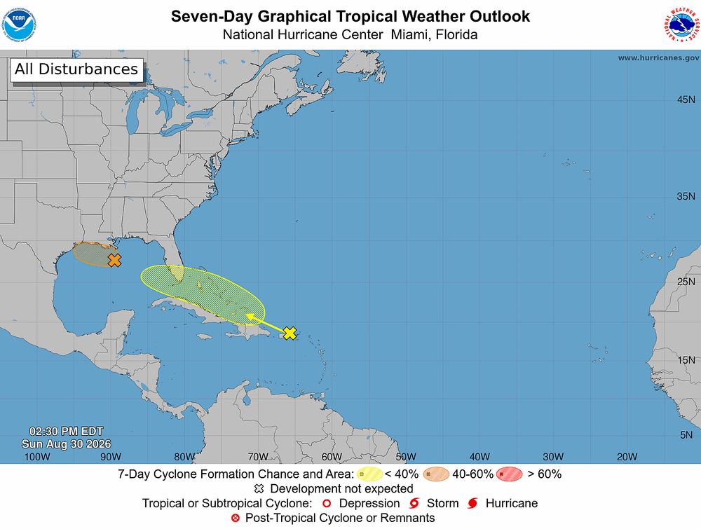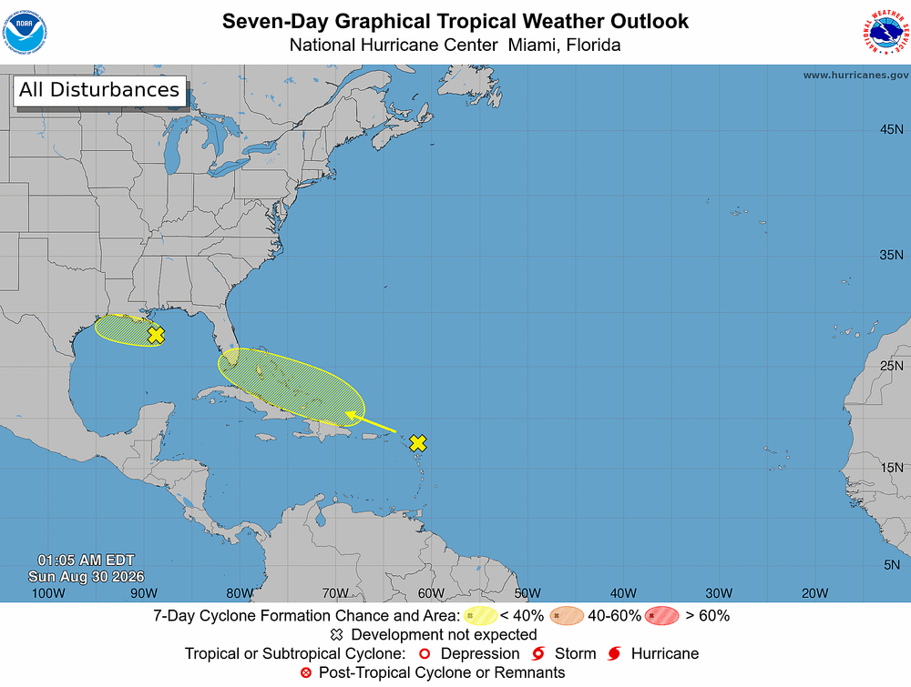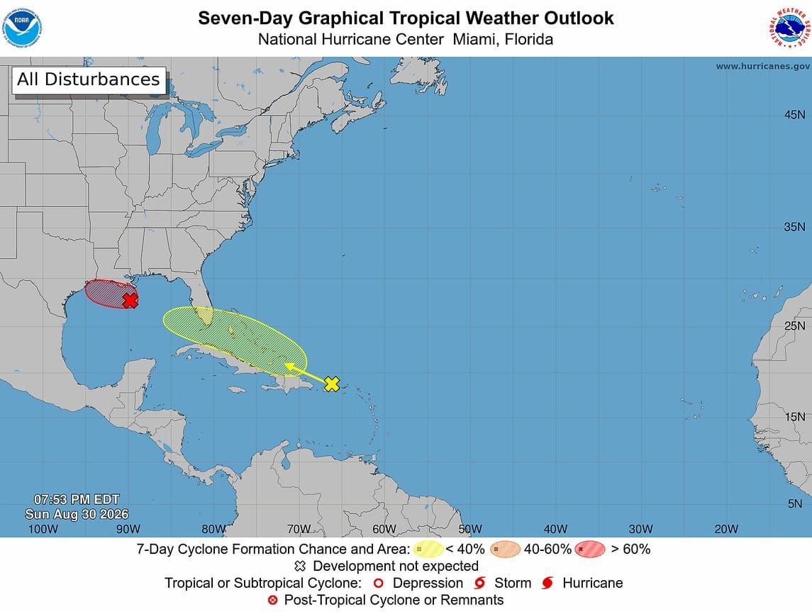
Tampa Bay may get a soaking midweek as what is left of Tropical Storm Dolly drifts toward Florida and into the southeastern Gulf. Nothing about it looks dangerous right now, but the timing puts the system near our coast around Wednesday and Thursday.
Forecasters give it a 20% chance of becoming a tropical depression or storm over the next seven days. Rain and rip currents are the realistic risks for the Bay area, not wind damage.
Where the system stands
Dolly's remnants are dumping heavy rain on Puerto Rico, the Virgin Islands and the northern Leeward Islands. As of Sunday evening, the storm had no closed center at the surface, and it is racing west around 25 mph. That speed, plus strong upper-level winds, makes it hard to rebuild over the next day or two.
Conditions could turn more favorable by midweek, when the system reaches the southeastern Gulf. Scattered thunderstorms already cover most of the Florida Peninsula and parts of the Bahamas.
A second system, far from here
A separate low sat about 125 miles south of southeastern Louisiana on Sunday afternoon. It poses no threat to Florida.
- It should reach the upper Texas or southwestern Louisiana coast Tuesday or Tuesday night.
- Sunday evenings updates gave it a 70% chance of developing within two days. Some later readings ran higher.
- Heavy rain is the main concern along coastal southwest Louisiana and the upper Texas coast.
What they would be called
If Dolly's leftovers pull together and winds hit 39 mph again, the system keeps the name Dolly. Forecasters would treat it as the same storm coming back to life.
The Gulf low would take the next name on the 2026 list, Edouard. Fay comes after that. Dolly was the season's fourth named storm, lasting two days, Aug. 27 to 28, with top winds of 35 mph.
What Bay area residents should do
Check the forecast Wednesday morning before making beach or boating plans. Rip currents can turn dangerous even when no storm forms.