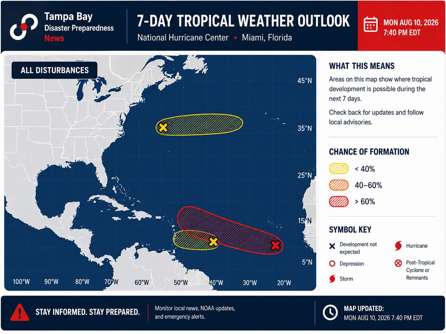
The Atlantic tropics are beginning to show more signs of life as forecasters monitor multiple areas for possible development. The system getting the most attention is an area of low pressure about 500 miles southwest of the Cabo Verde Islands. Widespread showers and thunderstorms are associated with the disturbance, and conditions are expected to become increasingly favorable for organization over the next several days.
The 8 PM outlook from the NHC has increased development chances for the eastern Atlantic wave to 30% over 48 hours and 70% overall. No changes on the other AOIs. pic.twitter.com/87oeFHnFCE
— Florida Tropics (@FloridaTropics1) August 11, 2026
The system now has a 30% chance of developing within 48 hours and a 70% chance over the next seven days. A tropical depression could form later this week as it moves west to west-northwest across the central tropical Atlantic.
If it strengthens into a tropical storm, Cristobal would be the next name on the 2026 Atlantic hurricane list.
TROPICAL UPDATE: The potential for Tropical Storm #Cristobal to form continues to increase in the open Atlantic. The NHC has bumped odds to a (Red) 70%. Here's the bottom line:
— Matt Devitt (@MattDevittWX) August 11, 2026
1) Right now *most* of the models have this curving north shown in the second image, but not all do.… https://t.co/UAOrs5gjd2 pic.twitter.com/wjTLusydcE
What does this mean for Tampa Bay?
For now, there is no immediate threat to Florida or the Tampa Bay area.
The disturbance remains thousands of miles away, and it has not yet developed into a tropical depression or storm. That means any forecasts showing where it could eventually travel come with considerable uncertainty.
Long-range computer models currently show a wide range of possibilities. Some guidance keeps the system well out over the Atlantic, while other scenarios bring it farther west. The spread is a reminder that forecasts this far in advance can change considerably, particularly before a storm has even formed.
The environment ahead of the disturbance could also become less favorable. Dry air and stronger upper-level winds, known as wind shear, could interfere with the system as it travels west. How organized the disturbance becomes before encountering those conditions will be important to watch.
August is when hurricane preparedness becomes increasingly important
The increase in tropical activity comes as the Atlantic hurricane season enters a historically more active period.
Even when a storm poses no immediate threat, Tampa Bay residents should use the quiet time to prepare rather than waiting until a hurricane or tropical storm is approaching.
Now is a good time to:
- Review your family's hurricane and evacuation plan.
- Know whether you live in an evacuation zone.
- Check emergency supplies, medications, batteries and flashlights.
- Make sure you have several ways to receive weather alerts.
- Review flood and homeowners insurance coverage.
- Make plans for pets and family members who may need additional assistance.
- Keep vehicles fueled and important documents protected.
The message for Tampa Bay right now is awareness, not alarm. There is no immediate threat, but conditions across the Atlantic are becoming more active and forecasts will become clearer if the disturbance develops a defined center.
Prepare now, monitor the tropics and don't wait for a storm to be headed toward Florida to get ready.