The Atlantic tropics are beginning to demand more attention as Florida moves closer to the historical peak of hurricane season.
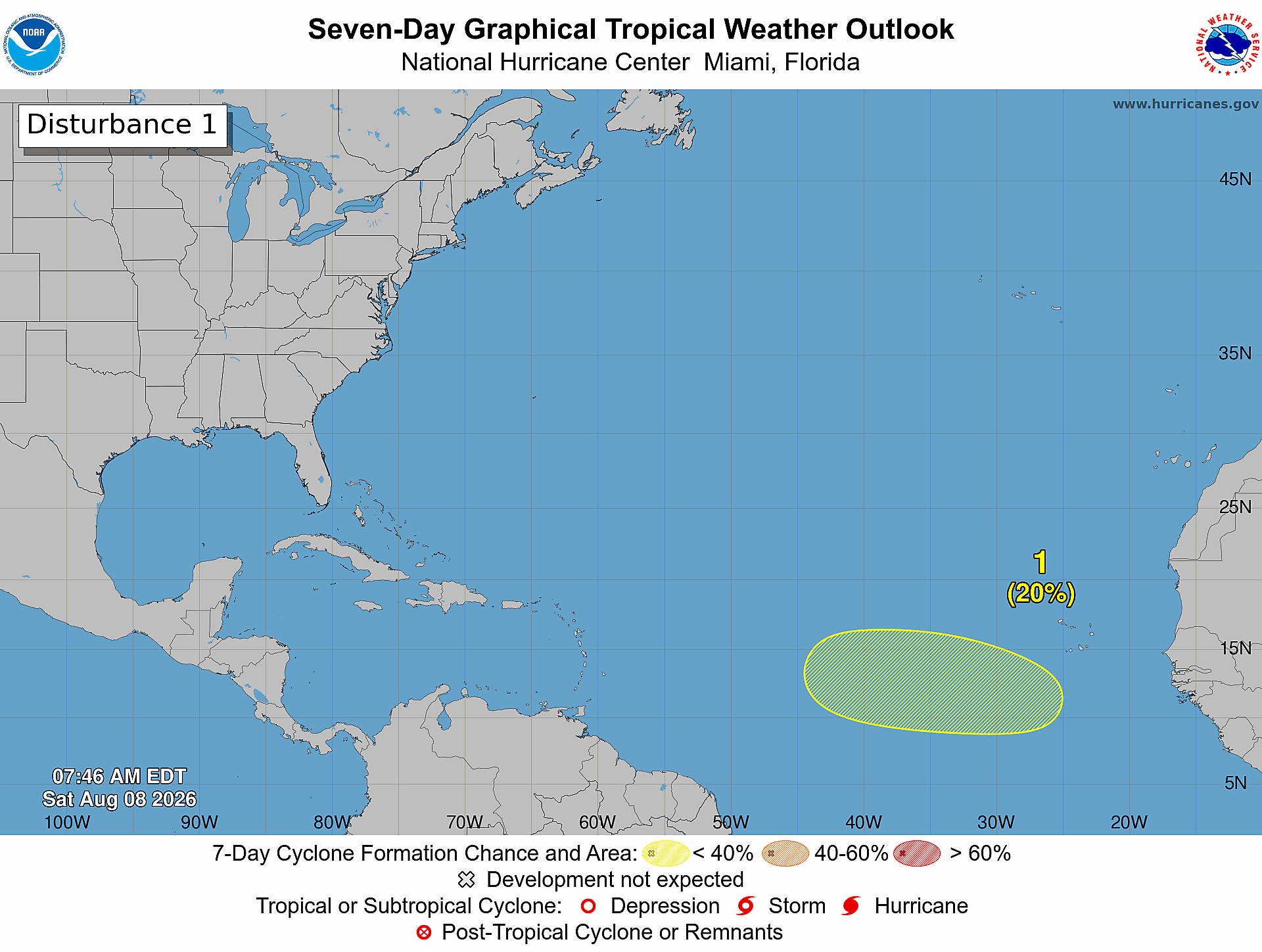
The National Hurricane Center is monitoring a tropical wave expected to move off the west coast of Africa and into the eastern and central tropical Atlantic. Forecasters currently give the disturbance a 20% chance of developing during the next seven days, while development during the next 48 hours is unlikely.
Saturday, Aug. 8: A tropical wave is expected to move off the west coast of Africa on Tuesday. Some development is possible during the middle to latter part of next week while the system moves westward over the eastern or central tropical Atlantic.
— National Hurricane Center (@NHC_Atlantic) August 8, 2026
More info:… pic.twitter.com/SHolpFHMzR
There is no immediate threat to Florida or the United States, and the system faces obstacles including dry Saharan air and strong upper-level winds.
But its appearance matters for a different reason: August marks the beginning of the period when Atlantic tropical activity historically accelerates.
El Niño doesn't mean no hurricanes
Florida is heading into peak season under El Niño, a climate pattern that typically increases strong upper-level winds, known as wind shear, across the Atlantic. Those winds can disrupt developing tropical systems.
That is one reason the National Oceanic and Atmospheric Administration, or NOAA, expects a quieter-than-normal Atlantic hurricane season in 2026.
But "below normal" describes the total amount of activity across the Atlantic — not whether a hurricane can strike Florida. Even during an El Niño year, favorable conditions can temporarily develop and allow individual storms to strengthen.
NOAA's seasonal outlook also emphasizes that most tropical activity typically occurs during August, September and October.
For Tampa Bay, now is the preparation window
A tropical wave thousands of miles away is not a reason to panic. It is a reason to use the quiet time wisely.
Once a storm threatens Florida, supplies can disappear quickly and evacuation decisions become more complicated. Residents should use August to review evacuation zones, know where they would go, check insurance documents, prepare medications and important records, and build or refresh a disaster supply kit.
For households that rely on electricity for medical equipment, August is also the time to establish a backup power plan rather than waiting for a hurricane watch.
Don't prepare for the forecast. Prepare for the impact.
The 2026 season has been relatively quiet so far, but seasonal forecasts cannot predict exactly where storms will make landfall.
For Tampa Bay, the greatest hazards also aren't limited to hurricane-force winds. Storm surge, flooding, tornadoes and extended power outages can occur even when the center of a tropical system stays away from the region.
The National Hurricane Center's outlooks extend seven days, meaning conditions can change considerably between the time a disturbance first appears and when it approaches land.
Bottom line: El Niño may tilt the odds toward a quieter Atlantic, but it doesn't make Tampa Bay hurricane-proof. With peak season approaching, the best time to prepare is while there is still no storm headed our way.
Track official tropical developments through the National Hurricane Center and find preparedness guidance through Florida's Division of Emergency Management


