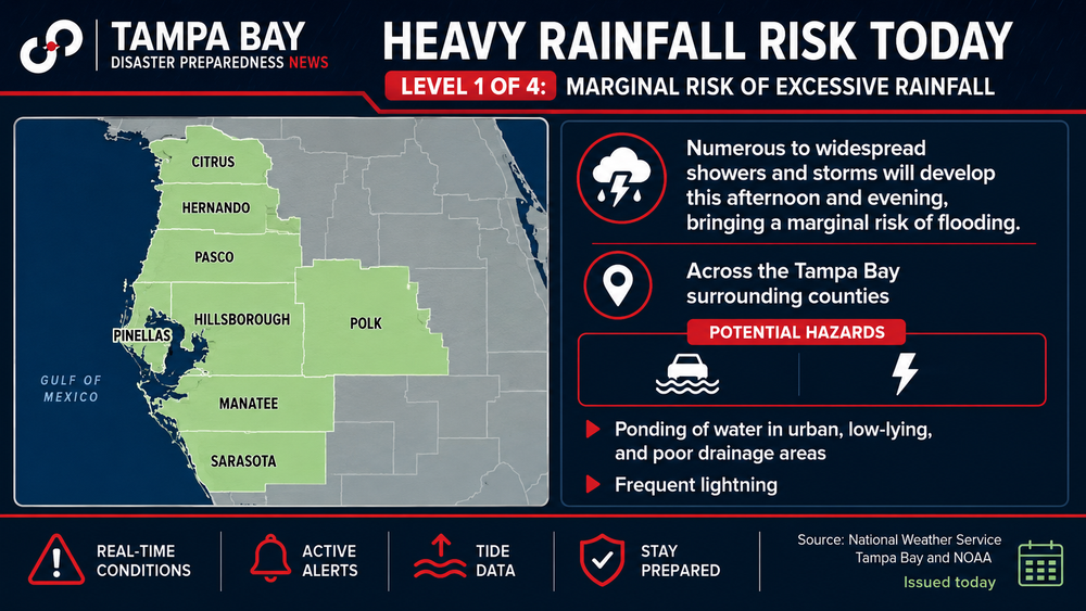
The tropics remain quiet, but Tampa Bay residents should prepare for a wetter weather pattern as a tropical wave moves toward Florida later this week.
Why it matters: Forecasters are not expecting tropical development, but the wave will pull deeper tropical moisture into Florida, increasing the likelihood of heavy afternoon thunderstorms, localized flooding and dangerous lightning.
Atmospheric moisture is forecast to climb from the seasonal average of about 1.8 inches to around 2.1 inches, creating a more favorable environment for widespread showers and storms.
For the Tampa Bay area, the shift means:
- Higher rain chances beginning Friday and continuing into the weekend.
- Typical afternoon and evening thunderstorms along the Gulf Coast.
- Periods of heavy rain that could produce localized street flooding.
- Frequent lightning and gusty winds with stronger storms.
Looking ahead: Forecast models continue to show a tropical wave crossing the Atlantic later this month, with some long-range guidance suggesting it could approach the Bahamas around Aug. 22-24. However, that system remains far out over the Atlantic and confidence is low. Current conditions, including dry air and wind shear, continue to limit tropical development.
What residents should do:
- Stay weather aware for changing afternoon storm forecasts.
- Never drive through flooded roadways.
- Secure outdoor items ahead of stronger thunderstorms.
- Use the quieter period now to review hurricane plans as the climatological peak of hurricane season approaches.
Bottom line: The immediate concern is a return to a wetter, more active thunderstorm pattern that could bring heavy rain and localized flooding. The broader Atlantic remains relatively quiet for now, but August marks the start of the busiest stretch of hurricane season, making this a good time to ensure disaster plans and emergency supplies are ready.